
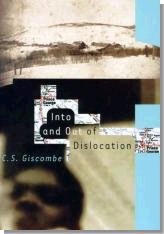
Book Excerpt: Into and Out of Dislocation
By C.S. Giscombe
Published by North Point Press; 0-86547-541-5; $24.00 US/$38.95 CAN
 Click on the image above to purchase this book |
It was on his third or fourth trip there that the poet C. S. Giscombe grew aware of the space Canada had staked out in his imagination. Giscombe later spent a winter with his family in British Columbia, and his time there becomes a lens through which he interrogates his preoccupation with Canada’s otherness. He writes that "border crossings are always sexy. And racial." And so this book is filled with both actual and metaphoric exploration — and Giscombe’s travels serve as points of departure for a series of meditations on racial, national, physical, and psychological borders.
At the heart of this book is the author’s ambivalent pursuit of John Robert Giscome, a man who may or may not be a relative. John R., as Giscombe calls him was a black Jamaican explorer who flourished in British Columbia during the last half of the nineteenth century. Giscombe documents the places that John R. passed through, and he uncovers stories about mining, pioneer life, and even cannibalism. Giscombe likes to imagine John R. as "a self-aware outsider," and that status comes to seem more important — more interesting — than any historical truth.
Into and Out of Dislocation is an intriguing and wryly told travel memoir by a writer Henry Louis Gates, Jr., calls "a major figure in contemporary African American letters."
Author
C.S. Giscombe is an English professor at Pennsylvania State University and lives with his family in State College. His recent poetry books include Giscome Road and Here. He is currently at work on a poetry sequence having to do with the Midwest and on a group of essays about train travel.
Reviews
"C.S. Giscombe’s Into and Out of Dislocation is an impressive book indeed. In it the author tracks the echoes of a historical figure who might, it seems, lead finally to himself. At the same time real life goes on, which proves an equal part of this profoundly engaging story."
–Robert Creely
"In Into and Out of Dislocation C.S. Giscombe addresses issues that have drawn the attention of African-American writers since the beginning of the tradition, but he does so with original insights. This is because he has expanded the universe to which readers of African-American writing have become accustomed and by doing so reveals the agony as well as the beauty of black life in this hemisphere in new ways. Into and Out of Dislocation with its change of scenes reads like the modern slave narrative, only the writer, a university professor, is seeking heritage instead of freedom. Ever the risk taker — in life, as well as art — he puts himself in situations where his reception can’t be predicted. Sometimes he is the only black person in town."
— Ishmael Reed
Excerpt
The following is an excerpt from the book Into and Out of Dislocation
by C.S. Giscombe
Published by North Point Press; $24.00 US/$38.95 CAN; 0-86547-541-5
Copyright © 2000 C.S. Giscombe
Grande Prairie, Alberta
Sometimes when I’m driving up Veterans Parkway, the boulevard that traces the eastern and southern edges of my city, Bloomington, Illinois, if the light’s right or close to right, I’ll suddenly remember Grande Prairie, Alberta, where I spent a night at the beginning of the summer of 1995.. I’m never startled, really, to recall Grande Prairie at those times — the road into that town had made me think of Bloomington when we arrived there dirty and tired after several days on the various northern highways — and I like remembering the place, Grande Prairie, and will tease the memory, once it’s arrived on its own and pretend between the banks of stoplights that it’s Alberta I’m crossing instead of downstate Illinois and that I’m heading for the Peace River instead of Kinko’s copies or the Schnucks superstore; or that I’m driving out to Fort Dunvegan or Fort St. John instead of off to teach my afternoon class at Illinois State University.
I was with my wife and our nine-year-old daughter. We’d been in northern Alberta for two days and I’d been surprised to discover how flat that part of the province was. I didn’t know Alberta well (and still don’t): before this trip, I’d only crossed it by train once, thirteen years earlier, and all I’d recalled of the province from that trip was the railroad track snaking through the incredible snowy mountains west of Calgary — Katharine and I had sat up at the top of the carpeted stairs in the coach’s observation dome for hours staring into the infinity of white peaks. And here were planted fields, the look of agribusiness, a landscape that should have been familiar to me because of Illinois. But until we came into the little city, Grande Prairie, it hadn’t felt like Illinois — the light we were encountering in the country was different from the light I was used to cutting through on the drive to Peoria or the drive to Champaign: there was a hazy quality to it, probably owing something to the forest fires that year, but that quality was disconcerting because I could see a great long way through the haze, out to where the horizon did blur into the sky. The surface of the earth there in Alberta seemed to be dishy, slightly concave in its flatness way into the distances, and the light seemed to exist not as a series of gradual, far-off wanings but as an ever-present, if less distinctly visible, entity. It seemed to be pooling in the fields.
We’d driven into Alberta — from Fort St. John, British Columbia — through that and come eventually to the Peace River at Dunvegan, where the landscape changed; we went down into the forested hills that rose above the water and camped in a provincial park. We spent the next day, which was cloudy, in some small towns along the Peace River and along the Smoky. Katharine was constructing a photo-essay about our travels along these rivers, and this low grey day was a challenge, she said, because of the kind of film she had in the camera. She photographed the Smoky from the spindly girder bridge at Watino and the Peace from the five-car ferry on which we crossed it for a third time — the first had been on the peculiar, curving span at Fort Dunvegan itself and the second was the long bridge that led into Peace River, Alberta, the town named for the water. Then we got over to Rycroft, where the rain started, and followed the straight road to Grande Prairie, dropping into town from the north.
At the eastern edge of Bloomington, Veterans is the long artery of upscale commerce. The east side’s the most profoundly white side of town and there Veterans Parkway is garlanded with frontage roads and has a grassy median strip and "smart" traffic signals that allow you to turn onto the access roads for the malls or for one of the McDonald’s or appallingly ridiculous Jumer’s Chateau, the huge restaurant-hotel built according to a fantasy of stuccoed Europe. Beyond Veterans the "good" suburbs are extending — town marches farther east into the cornfields and soybean fields each year — and the boulevard’s swath is a rough boundary between the older upper-middle-class neighborhoods (giant maples, straight streets, Prairie-style houses with recent additions) and the stark, newly built homes of surgeons and people in the insurance business (Bloomington’s the corporate headquarters for State Farm), these in neighborhoods with names like Harbour Pointe. Unlike other urban boundaries the parkway doesn’t separate discrete socioeconomic communities — its several lanes separate only styles. The sky, though, seems to well up above Veterans more than it wells up at any other place in Bloomington. Hardly anything is tall on the horizon and perhaps because of that the sky is simply most visible there, from along Veterans, from one’s automobile — during the afternoons, the light and clouds are incredible, nearly static presences, towering in fat vertical contrast to the divided lines of traffic. But the location of the light is different there: it’s specific and diverting and profoundly a thing. Yet even so, Veterans Parkway looks like a lot of places I can think of, effortlessly, in the East and Midwest — Far Hills Avenue in Dayton, Ohio, for example, or Erie Boulevard in Syracuse, Adlai E. Stevenson Drive in Springfield, Illinois, Central Avenue between Albany, N.Y., and Schenectady, etc. Some days I remember Grande Prairie but usually, if I’m thinking about location at all as I drive up Veterans, I think about how I could be at the edge of anywhere.
And because of that I had been surprised — as Katharine and Madeline and I came into Grande Prairie that evening in June — to be reminded so strongly of Bloomington’s strip; it had rained, as I mentioned, earlier in the afternoon, but that had stopped and the day had cleared and the air was bright and free of haze and here we were coming into an unexpectedly big town with a lot of traffic lights, restaurants, and motels. The sky was a presence. We were grubby — we’d camped the night before, as I said, at old Fort Dunvegan on its wild little hill above the Peace and we’d spent the night before that camping in the Rockies, in prosaically named Summit Pass, in B.C. The previous evening we’d tented at Mighty Moe’s Campground in the Cassiar Mountains near McDame Creek; that was one of the nights during this trip that it never quite got dark-twilight had lasted and lasted and swelled outside the tent. The air had seemed to become increasingly granular but it never really got dark.
We were actually making a long, wide circle — a two-week car and ferry trip — and Grande Prairie was the last stop before we arrived back at the starting point, Prince George, British Columbia, where we’d been renting a house near the Nechako River. Prince George is in the geographical center of the province, it’s the place where the north-south highway and the north-south railroad cross the ones going east and west. The Nechako flows into the big Fraser River at Prince George; the confluence is visible from Cottonwood Park downtown. It’s a hub, a lumber and railroad town, the only city of any note for several hundred miles in any direction. I had a Fulbright that year and this was where I needed to be — I’d wanted to figure out some ways to document the travels in northern British Columbia of the Jamaican miner John Robert Giscome. He’d flourished there, as they say, in the latter half of the nineteenth century and he was, perhaps, a relative of my — and Madeline’s — ancestors. He’d arrived in Prince George in the November of 1862, when it was Fort George, a Hudson’s Bay Company outpost; he was on his first prospecting trip north from Quesnell the village seventy miles south of Fort George where he’d been living, and he was accompanied by Henry McDame, a man from the Bahamas. They were headed for the Peace River country, where there was supposed to be a great quantity of gold, but the ice on the Fraser River stopped them and they hunkered down for the winter in Fort George. He was thirty-one years old then, I don’t know how old McDame would have been.
We’d arrived in Prince George in the winter too, or partway through it, in January, and were due to go back to the States at the end of June, so this would be our last trip out of town before that. Madeline was missing a little chunk of third grade but her teacher had agreed with us that this would be a worthwhile experience for her and that she could learn to multiply by seven later. It had been a pretty good jaunt-we’d taken the Yellowhead Highway west to the Pacific at Prince Rupert and caught the ferry from there up past Ketchikan and Wrangell and Juneau to Skagway, Alaska. From Skagway we’d made a detour to Whitehorse, the nearest city, the capital of the Yukon Territory, because Katharine was sick and needed a doctor and maybe was going to need a hospital. But it turned out all right and we were able to get back on the road after a couple of days in a motel and drive down into the Cassiar and through the Rockies and so forth. The Cassiar and the Rockies and the Peace River and Wrangell, Alaska, were important to the project because they were places John Robert Giscome had got to; Grande Prairie was not — it was a convenient juncture for us to clean up in and relax in for the last evening before the last day of travel, before we’d drive over Pine Pass and come down the Hart Highway back into Prince George. (And then we’d start packing up to really go home, to return to Bloomington.) Grande Prairie was on the flats, as its name suggests, on a high dry plateau devoid of the sorts of undulations that rivers provide, and John R. had gotten everywhere he went by water.
After the ice broke up on the Fraser in the April of 1863 Giscome and McDame had set out for the Peace River goldfields on the roundabout way that was standard then — eighteen miles on the winding Fraser north to the Salmon’s mouth and then northwest for twenty-some miles up the Salmon to a short, marshy portage to what’s now called Summit Lake. From there they were going to descend the Crooked River to McLeod Lake and the Parsnip River and eventually get to the Peace. But when they arrived at the place where the Salmon River flows into the Fraser they found the Salmon high and dangerous and their guide — a local man, an Indian — suggested that they go a little farther up the Fraser and take a short path he knew to a lake from which they’d be able to reach McLeod by canoe. That was in April. Much later, around Christmas, John R. would be down in Victoria talking about all this to the British Colonist, the newspaper there. The long front-page article, "Interesting from the Rocky Mountains," in the December 15 issue is the main source for my knowledge about his trip; it’s the main print source for what I can begin to know — or guess, really — about him. The paper notes that he and McDame "made a portage of about nine miles to a lake, leaving the canoes behind,” and at that lake they picked up another canoe — "from an old Indian Chief " — and came down the Crooked River (as it’s called now), getting eventually to McLeod Lake. There were no towns then, of course, only those forts dotting the landscape, sitting on the shores of lakes and rivers. At the fort at McLeod Lake "a salute of about 20 shots was fired, with firearms, in honor of the arrival of that party through that route which had never been traversed by any others than Indians." The route that Giscome and McDame had used — that "portage of about nine miles"–was a more dependable route to the north than the standard, one not subject to the vagaries of high water; by 1871 the path was known as the Giscome Portage and it appeared prominently on maps until the age of highways began after the First World War, at which point travel past the new city, Prince George (built at the townsite adjacent to old Fort George), began to stop meaning travel via lakes and rivers. Up until that point it was the way. That first lake that the partners came to after the portage, Summit Lake, is the beginning of the Arctic watershed; the Fraser flows south and enters the Pacific at Roberts Bank in Vancouver, but Summit Lake drains into the Crooked and the Crooked flows north into other rivers and lakes and, eventually, all that water gets to the Arctic Ocean. According to the Colonist story, John R. noted, as he and McDame left Summit Lake, that they were in a north-flowing river — he must have known he’d crossed the divide. The two of them did eventually make it to the Peace on their 1863 trip but found little there in the way of gold and, after some adventures, moved on to other sites in B.C. where they fared better.
Now, there’s something black people, or American black people of certain generations, say: we say that no matter where you go, no matter how far, no matter to what unlikely extreme, no matter what country, continent, ice floe, or island you land on, you will find someone else black already there. (In Fairview, Alberta, when I went into the 7-Eleven to ask where we might camp in the vicinity it was a big chocolate-colored man in blue overalls who said that he’d just driven his truck over from Fort Dunvegan, where there was a provincial park, and that we could be there in twenty minutes.) And maybe white people do something similar but on a grander scale, make a similar claim but one so unironically tied to civic identity and national consciousness as to be invisible, as to require no particular thought or self-consciousness: the local case in point is that most histories — casual and published — of B.C. start by mentioning the same fact, the same luminous detail, they all start off with Alexander Mackenzie being the first white man to enter what is now the province. The story is not indicative of some vicious racism on the part of its tellers but its presentation as a flat fact reveals the tendency that we all have to go along with things, to not question the conventional. When John R. and Henry McDame strolled into Fort McLeod, the Hudson’s Bay Company lads there at the fort fired off those shots in their honor, or in what John R. reported as honor, "in honor of the arrival of that party" over that trail "which had never been traversed by any others than Indians." I imagine that when people read that description in the newspaper they assumed that our heroes were two white guys; and I imagine John R. smiling as he or the newspaper reporter, or the two of them together, came up with that phrase, "any others than Indians." I imagine him smiling; I don’t know if he did. Who was the first black man to enter B.C.. Who was the first Giscome and how did he or she spell the name.?
And all my life I’ve been struck by how the world’s staked out by names — that the path between the Pacific and Arctic watersheds became the Giscome Portage, that’s the thing that brought me to Fort George a hundred and thirty-three years after John R. had wintered there. Of course, the name’s a spelling variation of my own family name, Giscombe, and all the handful of Giscomes and Giscombes I’d ever met or heard of up to the point of my own arrival at Fort George had been, as I am, black Jamaicans (by birth or by ancestry); Giscome or Giscombe is not the sort of name that one associates easily with the Arctic, with ice and snow. And British Columbia is a land of white people (who’ve written the place’s history, starting that book with A. Mackenzie), Chinese people, and Indians-that’s the standard racial breakdown in the province and white history in B.C. is an even more recent series of events than it is elsewhere in North America; "pioneer" appears with great frequency in the names of businesses and organizations in the province and various other white firsts (after Mackenzie’s) are casually mentioned in most conversations about the landscape. Photographs abound of the early days of the province — history is close by. But into that history, from the Bahamas and Jamaica, come Henry McDame and John Robert Giscome. They came into Fort George that winter and the latter’s black name got affixed to the geography around there: the portage wasn’t the only thing named for him — there’s also a town, thirty miles out from Prince George, and a canyon and a rapids, both on the Fraser, and a spate of other designations as well. And into that history — and into the land of ice and snow — came I and my little family; it wasn’t the first time we’d come to Prince George but it was the first time we’d arrived to dig in.
Prattville, Jamaica, West Indies
I finally went to Jamaica for the first time in the spring of 1996, after we’d been back from Prince George for almost a year. I went there rather specifically to interview John Aaron Giscombe, Jr., who was ninety-three years old then and who is the great-nephew of John Robert Giscome. He lives just outside of Prattville, a tiny place which is itself in the hills above Mandeville, a big market town in the center of the island. These hills are no region of Giscombe family origins, they’re where his wife’s people were from. All the Giscombes trace back to the parishes of the northeast coast, the northern side of the Blue Mountains: Buff Bay — where my grandfather was born — , Belcarres, Portland Parish, etc., places I’ve still never seen. Or that I’ve not seen yet. I suspect there’s a blood connection in all that geography, a link that’s out there waiting to be found between my grandfather’s people and that family, John R.’s. Or I imagine that there is; names rise in a number of different ways and if we do share some ancestry — if the same coupling long ago produced both John Robert Giscome and myself — I’ve certainly not discovered it, marked it, located it; I’ve been concerned, so far anyway, more with the peripheries than with a core.
Copyright © 2000 C.S. Giscombe and The Multiracial Activist {jos_sb_discuss:9}